
Maps by Archibald Fullarton
Showing all 16 results
-
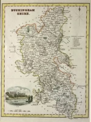
Buckinghamshire
Dated: c. 1830Image Dimensions: 7¼" x 10" (18.4cm x 25.4cm) -
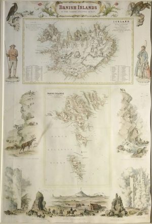
Danish Islands in the North Atlantic, Iceland & Faroe Islands
Dated: c. 1864Image Dimensions: 12¼" x 18¼" (31.1cm x 46.4cm) -
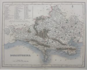
Dorset
Dated: C. 1840Image Dimensions: 9¾" x 7¾" (24.8cm x 19.7cm) -
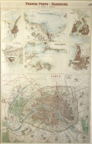
French Ports & Harbours & Plan of Paris, Boulogne, Le Havre, Marseille, Brest, Toulon, Cherbourg
Dated: c. 1864Image Dimensions: 11¾" x 18¼" (29.8cm x 46.4cm) -
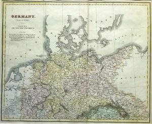
Germany, North Part
Dated: c. 1830Image Dimensions: 9¾" x 8" (24.8cm x 20.3cm) -
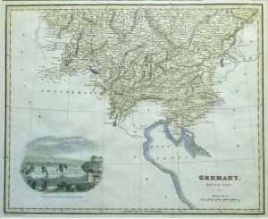
Germany, South Part
Dated: c1820Image Dimensions: 10" x 8¼" (25.4cm x 21cm) -

Herefordshire
Dated: c. 1830Image Dimensions: 7¾" x 10" (19.7cm x 25.4cm) -
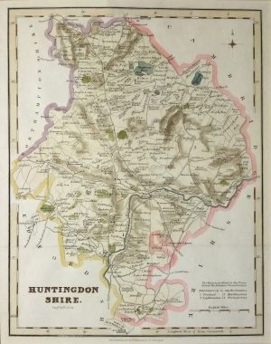
Huntingdonshire
Dated: c 1820Image Dimensions: 7¾" x 10" (19.7cm x 25.4cm) -
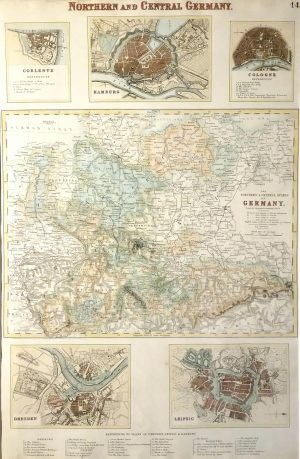
Northern & Central Germany with inserts of Hamburg, Cologne, Dresden, Leipsic & Coblentz
Dated: c. 1864Image Dimensions: 12" x 18¼" (30.5cm x 46.4cm) -
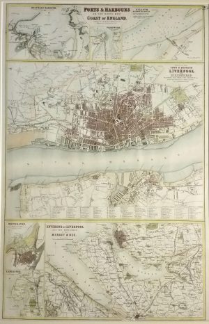
Ports & Harbours of the North West Coast of England, Liverpool, Holyhead, Whitehaven, Lancaster, Silloth, Fleetwood
Dated: c. 1864Image Dimensions: 12" x 18¼" (30.5cm x 46.4cm) -
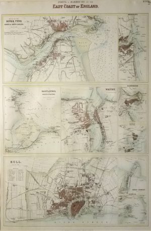
Ports & Harbours on the East Coast of Engalnd, Mouth of the Tyne, Hull, Hartlepool, Whitby, Sunderland, Scarborough,
Dated: c. 1864Image Dimensions: 12" x 18" (30.5cm x 45.7cm) -
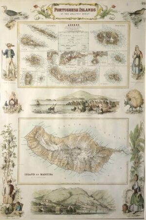
Portuguese Islands in the Atlantic, Madeira & Azores, border illustrations
Dated: c. 1864Image Dimensions: 12" x 18" (30.5cm x 45.7cm) -

Rutland
Dated: c. 1830Image Dimensions: 7¾" x 9¾" (19.7cm x 24.8cm) -
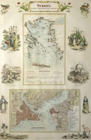
Turkey; Central Mediteranean Regions, Constantinople
Dated: c. 1864Image Dimensions: 12" x 18" (30.5cm x 45.7cm) -
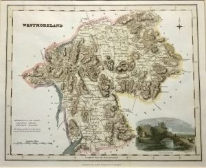
Westmorland
Dated: c 1820Image Dimensions: 10" x 8" (25.4cm x 20.3cm) -
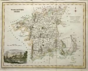
Worcestershire
Dated: c. 1830Image Dimensions: 9¾" x 7¾" (24.8cm x 19.7cm)