
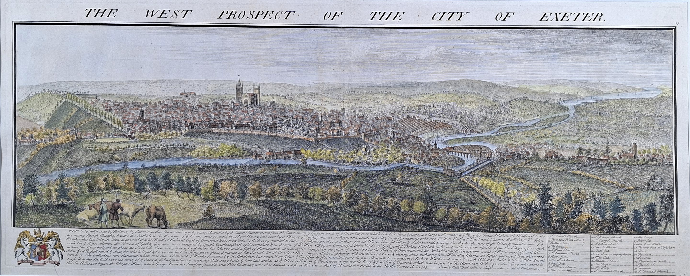
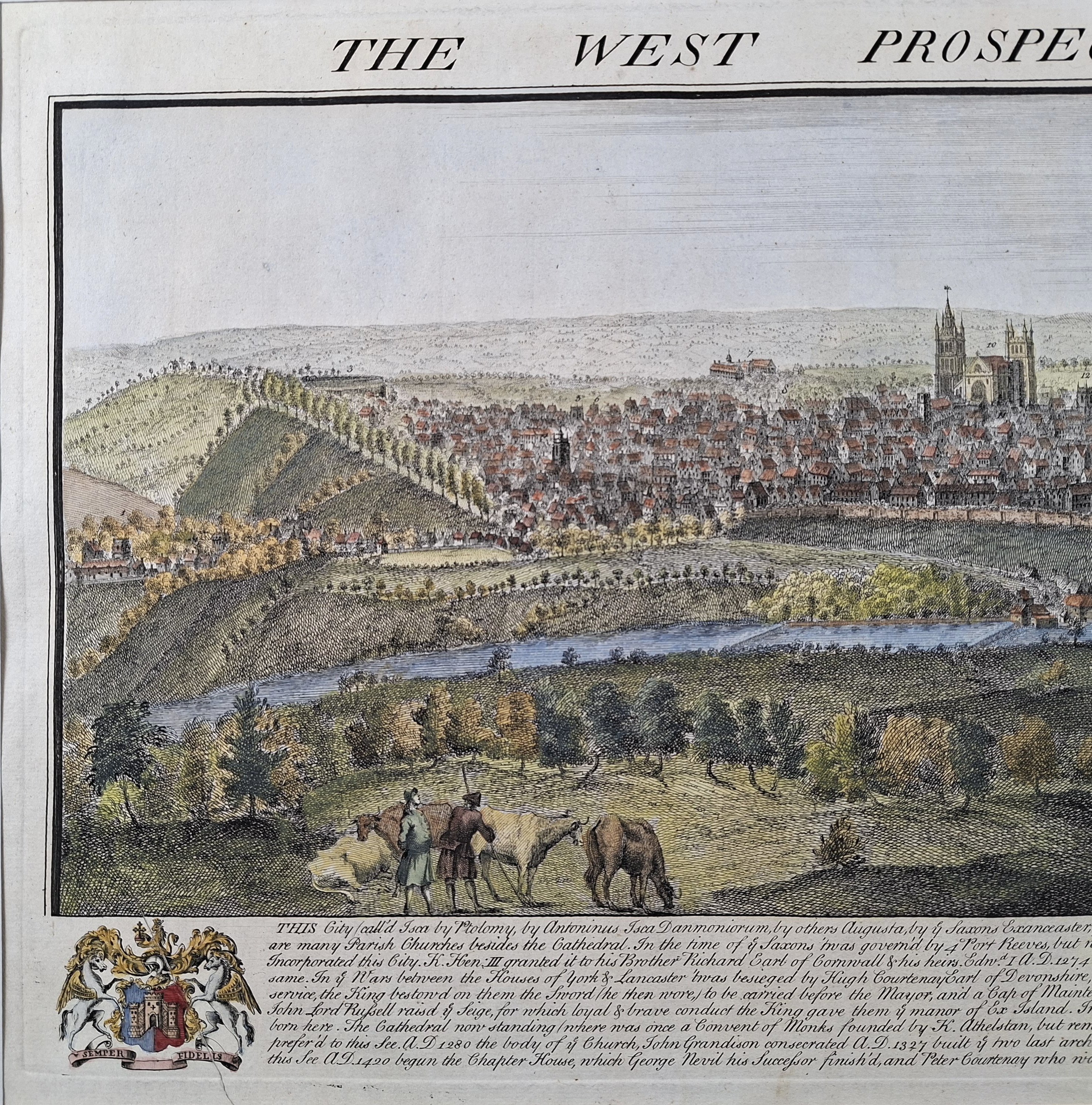
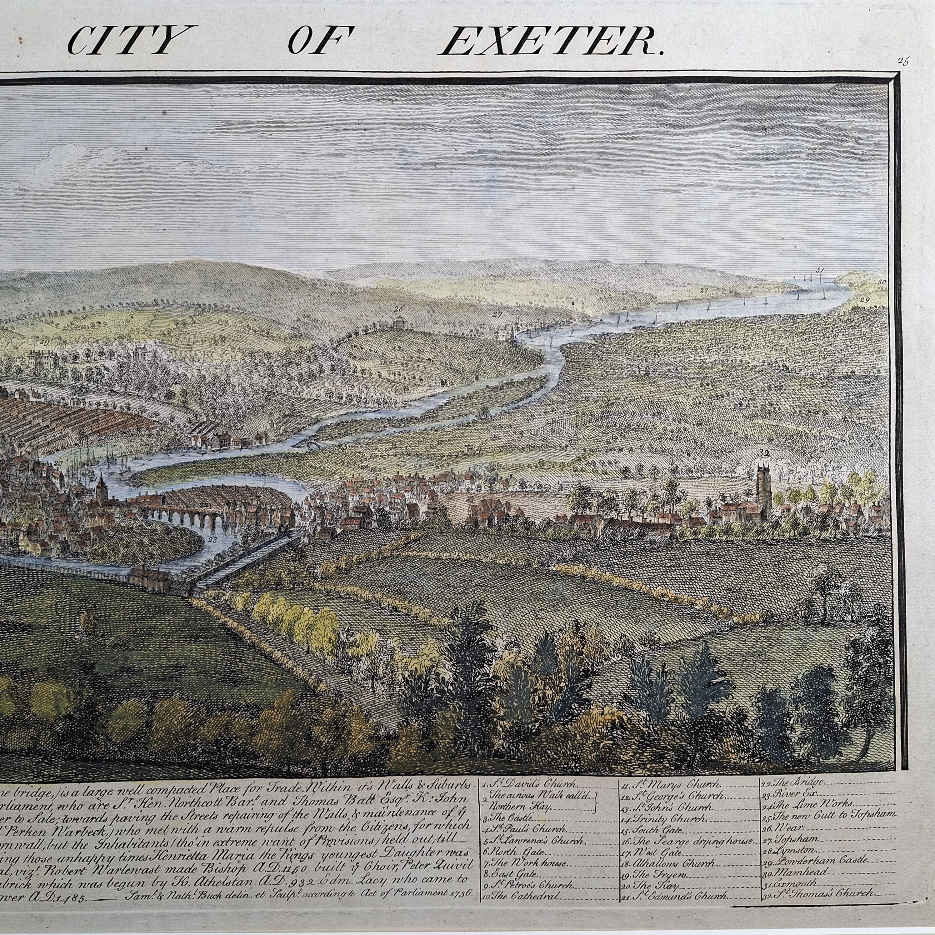
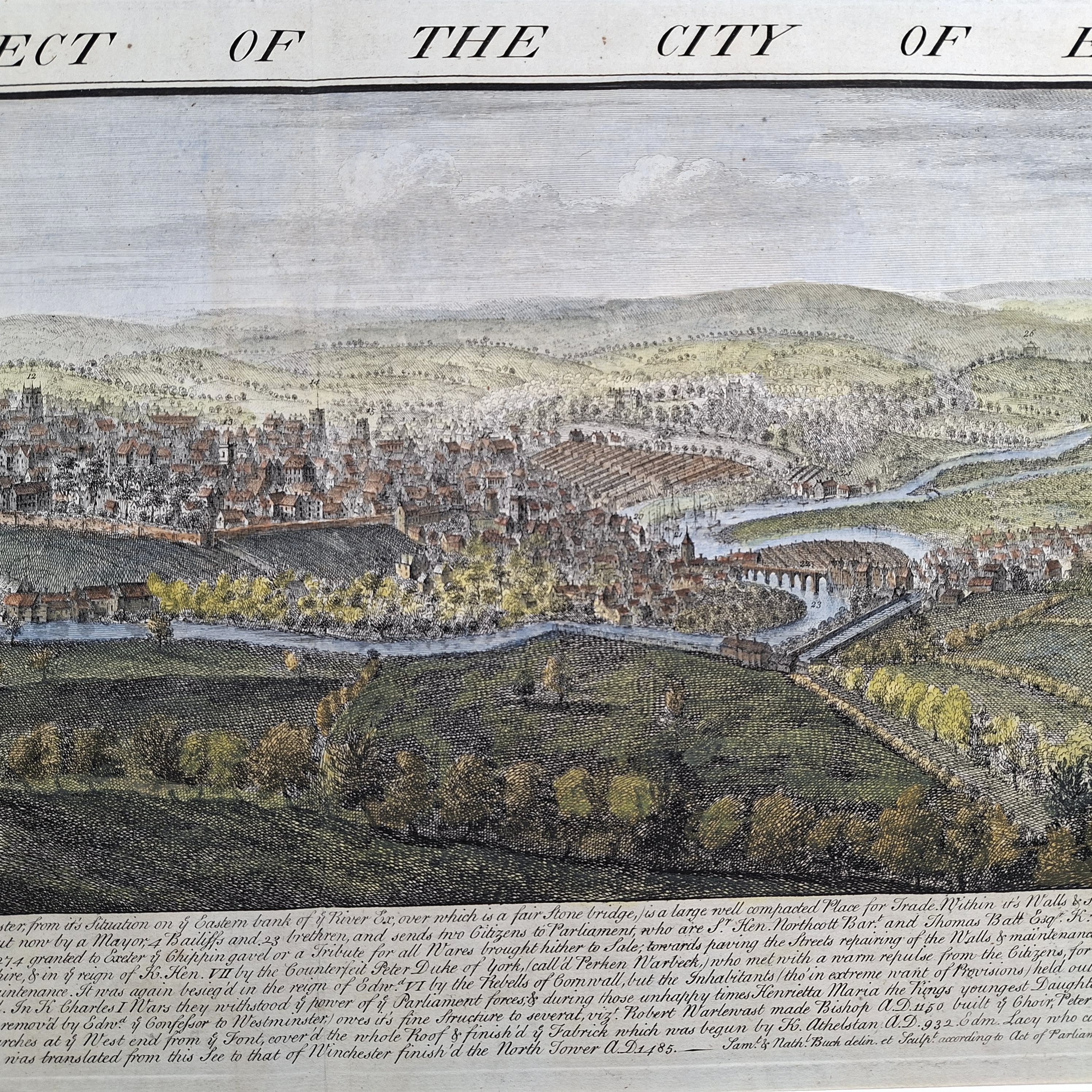
The West Prospect of the City of Exeter
This sweeping panoramic copperplate engraving from 1736 represents a landmark achievement in British urban topography. Drawn, engraved, and published by the celebrated brothers Samuel and Nathaniel Buck, this expansive plate belongs to their monumental series of long-view prospects documenting England and Wales’ historic cities and ports prior to the Industrial Revolution.
This exceptional work captures a complete bird’s-eye view of the historic city, framing it as a prosperous commercial and religious hub of the West Country.
Architecturally, the vista is anchored by the soaring twin towers of Exeter Cathedral (the Cathedral Church of Saint Peter), rising majestically above the medieval rooflines and the city’s ancient Roman and Norman defensive walls. The panoramic format emphasizes the city’s geographical integration with the meandering River Exe, showing the historic Exe Bridge spanning the waters toward the busy quay. At the bottom of the plate, the Bucks have included a meticulous, numbered text register indexing dozens of key architectural landmarks, civil buildings, and parish churches, making the print an invaluable cartographic and historic census of 18th-century Exeter.
The foreground injects an element of pastoral English life, featuring figures tending to livestock and horses along the rolling Devonshire hills, providing a tranquil contrast to the dense urban settlement across the river. To the lower left, the composition is proudly finished with the elaborate City of Exeter Coat of Arms, featuring its iconic twin-towered castle flankers and the motto Semper Fidelis. This highly sought-after engraving is an essential artifact for historians of Devonshire topography, classical town planning, and fine Georgian printmaking.
Contact us on 01935 814465 or use the form below.
You May Also Like
-
 Oil Paintings
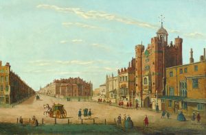
Banquet Hall, Whitehall in 1750; St. James’s Palace & Pall Mall in 1750
Medium: Oil on canvasProvenance: SignedImage Dimensions: 23½" x 15¼" (59.69cm x 38.74cm) -
 Watercolours
A Continental Lakeside Town
Medium: WatercolourDated: 1860Provenance: SignedImage Dimensions: 19" x 7½" (48.3cm x 19.1cm) -
 Antique Maps
Antique Map of Plan of Aldersgate, Bishopsgate, Bread Street & Cordwainers Wards by John Royce
Dated: 1784Image Dimensions: 8¾" x 13½" (22.2cm x 34.3cm) -
 Antique Prints
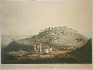
The Town of Dixan in Abyssinia
Dated: 1809Image Dimensions: 24" x 18¼" (61cm x 46.4cm)