

Antique Maps
Antique Map of French Ports & Harbours & Plan of Paris, Boulogne, Le Havre, Marseille, Brest, Toulon, Cherbourg by Archibald Fullarton
Dated: c. 1864
Image Dimensions: 11¾" x 18¼" (29.8cm x 46.4cm)
Price:
£130.00
Antique map
Very scarce.
Contact us on 01935 814465 or use the form below.
You May Also Like
-
 Oil Paintings
The Market, Concarneau, France
Medium: Oil on canvasProvenance: SignedImage Dimensions: 13½" x 9½" (34.3cm x 24.1cm) -
 Watercolours
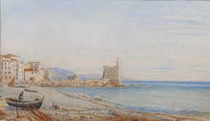
Mentone, France
Medium: WatercolourProvenance: Signed & inscribedImage Dimensions: 19" x 10¾" (48.3cm x 27.3cm) -
 Antique Maps
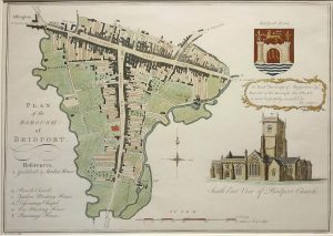
Antique Map of Plan of the Borough of Bridport by Bayly
Dated: c. 1800 (c. 1865 Edition)Image Dimensions: 13½" x 9½" (34.3cm x 24.1cm) -
 Antique Prints
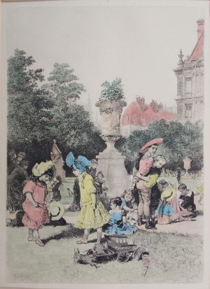
Tuileries Garden, Paris, France
Dated: c.1880Image Dimensions: 7" x 9½" (17.8cm x 24.1cm)