
England (& Great Britain)
This is our current list of England (& Great Britain) Maps stocked in our gallery. Please use the Enquire Now button to ask a question or order and we will be back to you as soon as possible.
Showing all 10 results
-

A New Map of the Kingdom of England & Dominion of Wales
Dated: C. 1675Image Dimensions: 19½" x 15" (49.5cm x 38.1cm) -

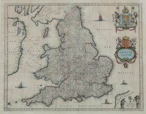
Anglia Regnum
Dated: c.1688Image Dimensions: 22¾" x 19¼" (57.8cm x 48.9cm) -
Anglia Regnum framed
Dated: c 1646Image Dimensions: 20¼" x 16" (51.4cm x 40.6cm) -
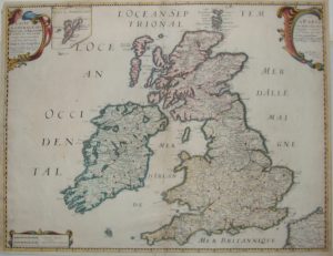
Carte General des Royume Angleterre, Ecosse & Irlande, (Great Britain & Ireland)
Dated: 1640Image Dimensions: 20½" x 15¾" (52.1cm x 40cm) -
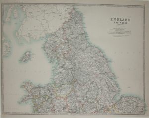
England & Wales, Northern Sheet
Dated: c. 1880Image Dimensions: 23½" x 18½" (59.7cm x 47cm) -

Great Britain
Dated: c 1675Image Dimensions: 20¼" x 15¾" (51.4cm x 40cm) -
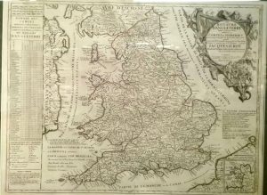
Le Royavme D’Angleterre
Dated: 1689Image Dimensions: 23¼" x 18¼" (59.1cm x 46.4cm) -

Mercia & East Anglia
Dated: 1654Image Dimensions: 23" x 14½" (58.4cm x 36.8cm) -
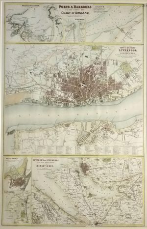
Ports & Harbours of the North West Coast of England, Liverpool, Holyhead, Whitehaven, Lancaster, Silloth, Fleetwood
Dated: c. 1864Image Dimensions: 12" x 18¼" (30.5cm x 46.4cm) -
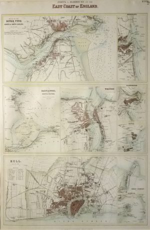
Ports & Harbours on the East Coast of Engalnd, Mouth of the Tyne, Hull, Hartlepool, Whitby, Sunderland, Scarborough,
Dated: c. 1864Image Dimensions: 12" x 18" (30.5cm x 45.7cm)