
Maritime Charts
This is our current list of Maritime Charts Maps stocked in our gallery. Please use the Enquire Now button to ask a question or order and we will be back to you as soon as possible.
Showing all 23 results
-
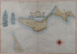
A Draught of Portland, The Shambles & the Race of Portland
Dated: c. 1779Image Dimensions: 24" x 16½" (61cm x 41.9cm) -
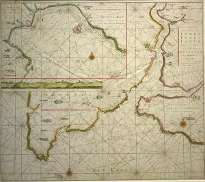
Chart of the River Fowey and Mounts Bay
Dated: 1728Image Dimensions: 23½" x 20½" (59.7cm x 52.1cm) -
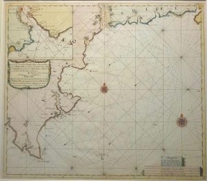
Coast of Devonshire, extending from Bridport to Big Berry
Dated: C. 1775Image Dimensions: 23¼" x 20½" (59.1cm x 52.1cm) -
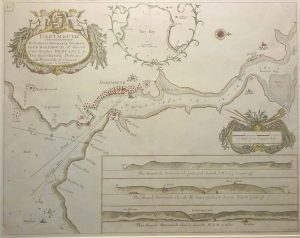
Dartmouth
Dated: 1693Image Dimensions: 23" x 18" (58.4cm x 45.7cm) -
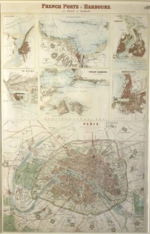
French Ports & Harbours & Plan of Paris, Boulogne, Le Havre, Marseille, Brest, Toulon, Cherbourg
Dated: c. 1864Image Dimensions: 11¾" x 18¼" (29.8cm x 46.4cm) -

Holyhead
Dated: C. 1696Image Dimensions: 22½" x 18" (57.2cm x 45.7cm) -
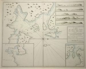
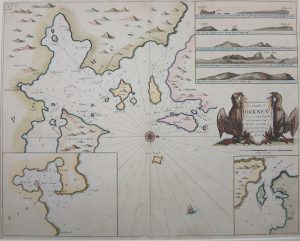
Islands of Orkney – chart, French Edition
Dated: 1690Image Dimensions: 23" x 18½" (58.4cm x 47cm) -
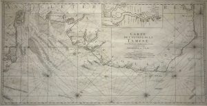
Map of the Thames Estuary, Carte de L’entrée de la Tamise
Dated: 1693Image Dimensions: 35½" x 18¼" (90.2cm x 46.4cm) -
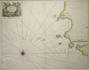
Milford Haven Islands
Dated: c. 1693Image Dimensions: 22½" x 18" (57.2cm x 45.7cm) -
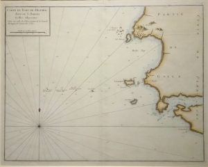
Milford Haven Islands, French ed.
Dated: c.1750Image Dimensions: 20½" x 16½" (52.1cm x 41.9cm) -
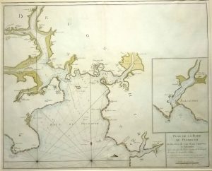
Plan de la Rade de Plymouth, French Edition
Dated: c.1700Image Dimensions: 22¼" x 18" (56.5cm x 45.7cm) -
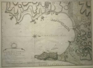
Plan of the Bay, Rock & Town of Gibraltar
Dated: 1783Image Dimensions: 28¾" x 20¾" (73cm x 52.7cm) -
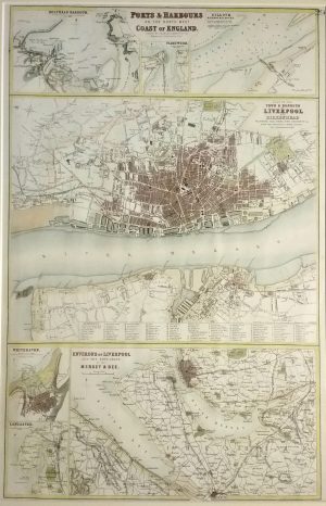
Ports & Harbours of the North West Coast of England, Liverpool, Holyhead, Whitehaven, Lancaster, Silloth, Fleetwood
Dated: c. 1864Image Dimensions: 12" x 18¼" (30.5cm x 46.4cm) -
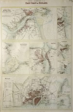
Ports & Harbours on the East Coast of Engalnd, Mouth of the Tyne, Hull, Hartlepool, Whitby, Sunderland, Scarborough,
Dated: c. 1864Image Dimensions: 12" x 18" (30.5cm x 45.7cm) -
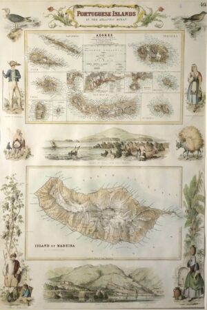
Portuguese Islands in the Atlantic, Madeira & Azores, border illustrations
Dated: c. 1864Image Dimensions: 12" x 18" (30.5cm x 45.7cm) -
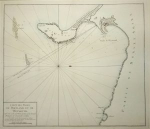
Sea Chart of Portland & Weymouth; French Edition
Dated: c. 1720Image Dimensions: 19½" x 17" (49.5cm x 43.2cm) -
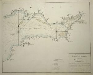
Sea Chart of The Bristol Channel, River Severn & Bristol; French Edition
Dated: c. 1720Image Dimensions: 23" x 18½" (58.4cm x 47cm) -
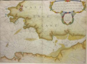
South Wales
Dated: 1628Image Dimensions: 14" x 10½" (35.6cm x 26.7cm) -
The Chief Harbours in the Islands of Orkney
Dated: C. 1675Image Dimensions: 22¼" x 17¾" (56.5cm x 45.1cm) -
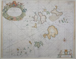
The Islands of Scilly
Dated: C. 1695Image Dimensions: 22½" x 18" (57.2cm x 45.7cm) -
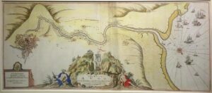
The River Avon from the Severn to the Citty of Bristoll (Bristol)
Dated: C. 1690Image Dimensions: 16¼" x 37¼" (41.3cm x 94.6cm) -
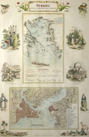
Turkey; Central Mediteranean Regions, Constantinople
Dated: c. 1864Image Dimensions: 12" x 18" (30.5cm x 45.7cm) -
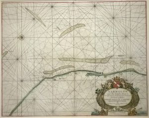
Yarmouth and the Sands about it
Dated: c. 1693Image Dimensions: 22¾" x 18" (57.8cm x 45.7cm)