
Town Plans
This is our current list of Town Plans Maps stocked in our gallery. Please use the Enquire Now button to ask a question or order and we will be back to you as soon as possible.
Showing 1–24 of 31 results
-
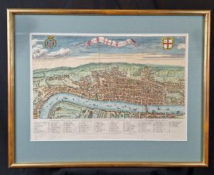
A View of London about the Year 1560
Medium: Copper EngravingEngraver: George VirtueDated: 1738Image Dimensions: 23¾" x 18½" (60.33cm x 46.99cm) -

A Map of the Country Seven Miles Round Taunton
Dated: C. 1800Image Dimensions: 19" x 22" (48.3cm x 55.9cm) -
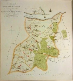
A map of the Hundred of Boughton Blean, (Hernhill, Seasalter, Graveney)
Dated: C. 1797Image Dimensions: 15¼" x 17" (38.7cm x 43.2cm) -
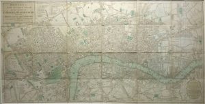
Bowles’s New Pocket Plan of the Cities of London and Westminster with the Borough of Southwark
Dated: 1788Image Dimensions: 36¼" x 18¼" (92.1cm x 46.4cm) -
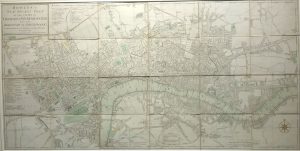
Bowles’s New Pocket Plan of the Cities of London and Westminster with the Borough of Southwark
Dated: 1785Image Dimensions: 36" x 18" (91.4cm x 45.7cm) -
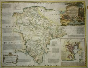
Devon with a plan of Plymouth
Dated: C. 1763Image Dimensions: 27" x 21" (68.6cm x 53.3cm) -
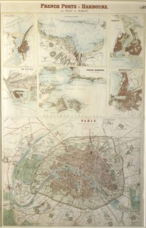
French Ports & Harbours & Plan of Paris, Boulogne, Le Havre, Marseille, Brest, Toulon, Cherbourg
Dated: c. 1864Image Dimensions: 11¾" x 18¼" (29.8cm x 46.4cm) -

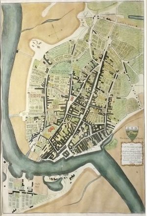
Langborne Ward
Dated: c. 1720Image Dimensions: 14¾" x 12" (37.5cm x 30.5cm) -
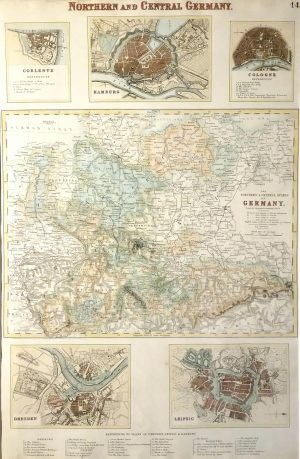
Northern & Central Germany with inserts of Hamburg, Cologne, Dresden, Leipsic & Coblentz
Dated: c. 1864Image Dimensions: 12" x 18¼" (30.5cm x 46.4cm) -

Plan of Aldersgate, Bishopsgate, Bread Street & Cordwainers Wards
Dated: 1784Image Dimensions: 8¾" x 13½" (22.2cm x 34.3cm) -
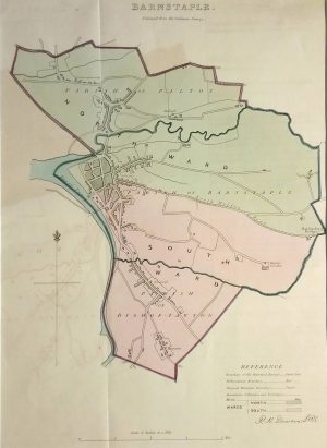
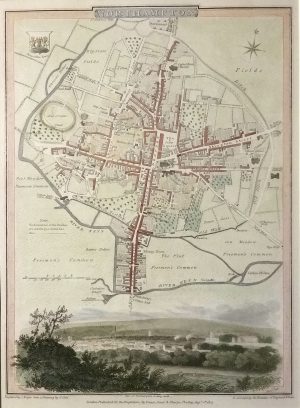
Plan of Barnstaple
Dated: c. 1840Image Dimensions: 9" x 12½" (22.9cm x 31.8cm) -
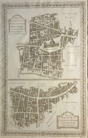
Plan of Baynards Castle, Farringdon, Candlewick & Langborn Wards
Dated: 1784Image Dimensions: 8½" x 13¼" (21.6cm x 33.7cm) -
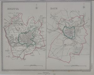
Plan of Bristol and Bath
Dated: C. 1870Image Dimensions: 9¾" x 7¾" (24.8cm x 19.7cm) -
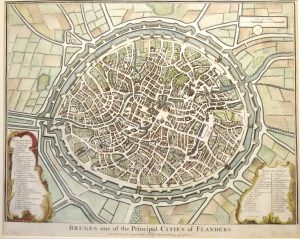
Plan of Bruges one of the principal cities of Flanders
Dated: c. 1745Image Dimensions: 18¾" x 15" (47.6cm x 38.1cm) -
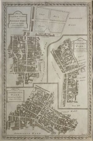
Plan of Coleman Street, Bassishaw, Portsoken & Cripplegate Wards
Dated: 1784Image Dimensions: 8¾" x 13¼" (22.2cm x 33.7cm) -
Plan of Dorchester
Dated: C. 1794Image Dimensions: 9¾" x 12¾" (24.8cm x 32.4cm) -
Plan of Northampton
Dated: 1807Image Dimensions: 7¼" x 10" (18.4cm x 25.4cm) -
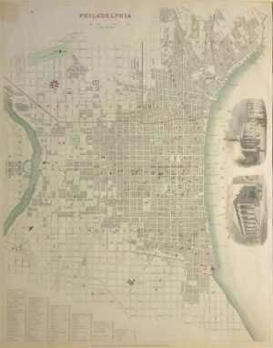
Plan of Philadelphia
Dated: 1885Image Dimensions: 12¼" x 15" (31.1cm x 38.1cm) -
Plan of Poole
Dated: C.1865Image Dimensions: 9¼" x 13½" (23.5cm x 34.3cm) -
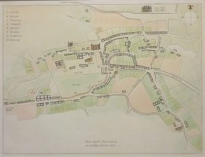
Plan of Shaftesbury (1615)
Dated: C. 1865Image Dimensions: 12" x 9¼" (30.5cm x 23.5cm) -
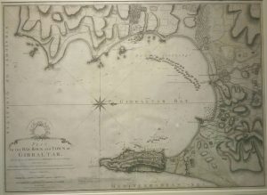
Plan of the Bay, Rock & Town of Gibraltar
Dated: 1783Image Dimensions: 28¾" x 20¾" (73cm x 52.7cm) -
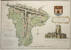
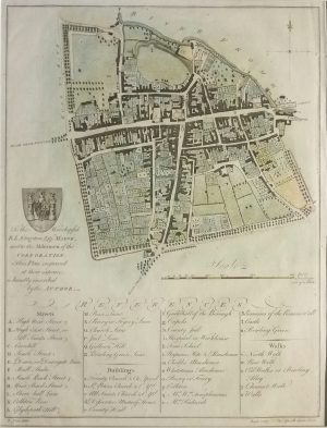
Plan of the Borough of Bridport
Dated: c. 1800 (c. 1865 Edition)Image Dimensions: 13½" x 9½" (34.3cm x 24.1cm) -
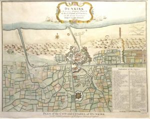
Plan of the City & Citadel of Dunkirk
Dated: c. 1745Image Dimensions: 19½" x 15½" (49.5cm x 39.4cm) -
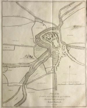
Plan of the Town & Castle of Corfe, surveyed in 1586
Dated: C. 1865Image Dimensions: 10" x 12½" (25.4cm x 31.8cm)