


Antique Maps
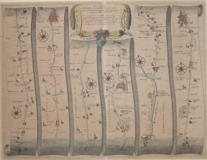
A View of London about the Year 1560
Medium: Copper Engraving
Engraver: George Virtue
Dated: 1738
Image Dimensions: 23¾" x 18½" (60.33cm x 46.99cm)
Price:
£950.00
This iconic plan, often called the “Agas Map,” was published as a frontispiece for Volume I of William Maitland’s History and Survey of London in 1738. It was engraved by George Vertue, who based it on an “ancient print” in the collection of Sir Hans Sloane.
Contact us on 01935 814465 or use the form below.
You May Also Like
-
 Oil Paintings
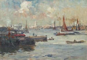
On the Thames at Limehouse Reach, London
Medium: Oil on canvas boardProvenance: Signed, inscribed versoImage Dimensions: 16" x 11½" (40.6cm x 29.2cm) -
 Watercolours
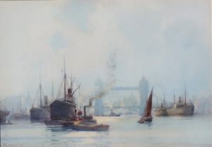
The Thames at Tower Bridge, London
Medium: WatercolourProvenance: SignedImage Dimensions: 28" x 20" (71.1cm x 50.8cm) -
 Antique Maps
Antique Map of London to Kingslyn, London-Puckering by John Ogilby
Dated: c.1675Image Dimensions: 17½" x 13¼" (44.5cm x 33.7cm) -
 Antique Prints
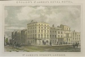
St. James’s Royal Hotel, st. James’s Street, London
Dated: c. 1840Image Dimensions: 4¾" x 3¼" (12.1cm x 8.3cm)