

Antique Maps
Antique Map of Map of the Thames Estuary, Carte de L’entrée de la Tamise by Nicholas Bellin
Dated: 1693
Image Dimensions: 35½" x 18¼" (90.2cm x 46.4cm)
Price:
£475.00
Antique map
Contact us on 01935 814465 or use the form below.
You May Also Like
-
 Oil Paintings
On the Thames near Cookham
Medium: Oil on canvasProvenance: Signed & Inscribed on ReverseImage Dimensions: 38" x 23" (96.5cm x 58.4cm) -
 Watercolours
Homeward Bound (on the River Thames, London)
Medium: WatercolourDated: 1891Provenance: Signed & inscribedImage Dimensions: 24¾" x 13½" (62.9cm x 34.3cm) -
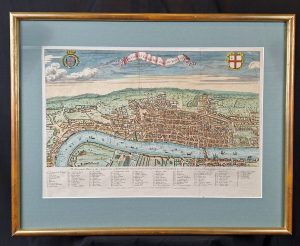 Antique Maps
A View of London about the Year 1560
Medium: Copper EngravingDated: 1738Image Dimensions: 23¾" x 18½" (60.33cm x 46.99cm) -
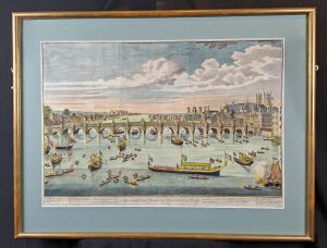 Antique Prints
The South East Prospect of Westminster Bridge, London
Medium: Copper EngravingDated: 1760Image Dimensions: 22½" x 15½" (57.15cm x 39.37cm)