

Antique Maps
Antique Map of Plan de la Rade de Plymouth, French Edition by Capt. Grenville Collins
Dated: c.1700
Image Dimensions: 22¼" x 18" (56.5cm x 45.7cm)
Price:
£275.00
Antique map
Contact us on 01935 814465 or use the form below.
You May Also Like
-
 Oil Paintings
Martigues, France
Medium: Oil on boardProvenance: SignedImage Dimensions: 20" x 15" (50.8cm x 38.1cm) -
 Watercolours
Albi, Tarn, France
Medium: WatercolourDated: 1994Provenance: Signed & inscribedImage Dimensions: 13" x 18" (33cm x 45.7cm) -
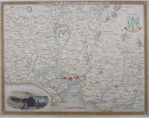 Antique Maps
Antique Map of The Environs of Plymouth & Devonport by Thomas Moule
Dated: C. 1840Image Dimensions: 10½" x 8" (26.7cm x 20.3cm) -
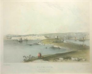 Antique Prints
Plymouth from Mount Batten
Dated: C. 1840Image Dimensions: 12" x 9¾" (30.5cm x 24.8cm)