
Antique Maps
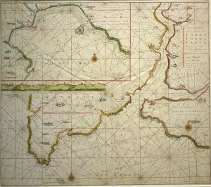
Antique Map of Sea Chart of The Bristol Channel, River Severn & Bristol; French Edition by Capt. Grenville Collins
Dated: c. 1720
Image Dimensions: 23" x 18½" (58.4cm x 47cm)
Price:
£195.00
Antique map
Contact us on 01935 814465 or use the form below.
You May Also Like
-
 Oil Paintings
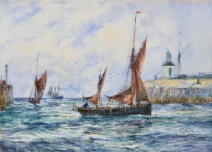
On the River Exe Looking towards Lympsham, Devon
Medium: Oil on canvasProvenance: SignedImage Dimensions: 29½" x 19½" (74.9cm x 49.5cm) -
 Watercolours
Return of the Boats, Gorleston-on-Sea, Norfolk
Medium: WatercolourProvenance: Signed, inscribed under mountImage Dimensions: 13¼" x 9¼" (33.7cm x 23.5cm) -
 Antique Maps
Antique Map of Chart of the River Fowey and Mounts Bay by G. Van Keulen
Dated: 1728Image Dimensions: 23½" x 20½" (59.7cm x 52.1cm) -
 Antique Prints
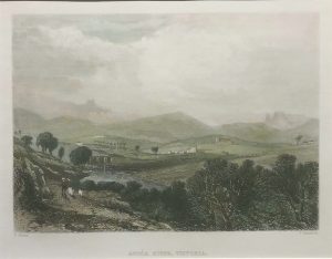
Avoca River, Victoria
Dated: c 1840Image Dimensions: 8" x 6¼" (20.3cm x 15.9cm)